
The trailhead to Cinder Cone is located in the northeast corner of Lassen Volcanic National Park at Butte Lake. From Highway 44, follow signs to head south on Forest Road 32N21 for 5 miles to the trailhead at Butte Lake near Butte Lake Campground. This road is only open May through October, depending on conditions. The trail begins at a small parking lot just beyond the boat launch. Additional parking, restrooms, and potable water are located in the larger parking loop as you drive in.
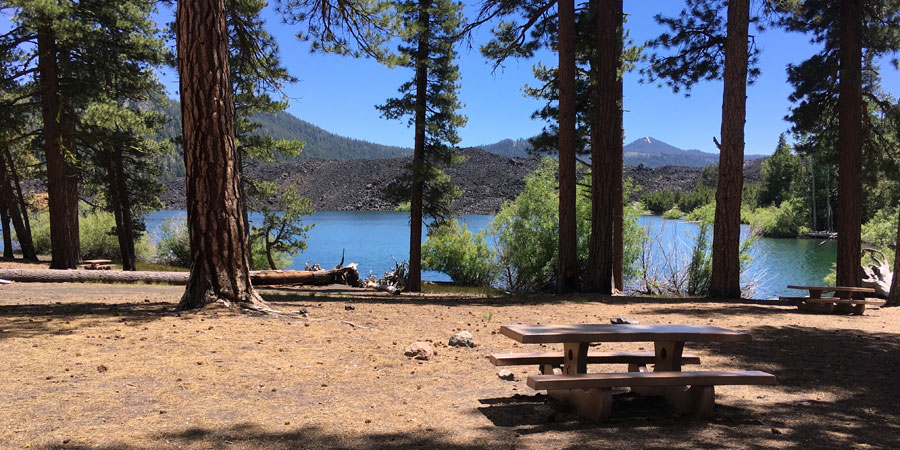
Picnic tables and modern restrooms are available right beside the lake
This hike can be broken down into two distinct pieces - the forest approach and the ascent up Cinder Cone.
The approach is a very gradual hike through a beautiful old growth ponderosa pine forest. If you’re interested in learning more about the ecosystem and geology, grab an interpretive brochure at the trailhead and follow along. Some of the markers are missing but there is still a lot to learn just by reading. While this is a very level trail, there are pockets of loose sand that make walking a little more energy intensive than normal.
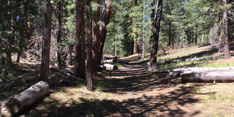
Ponderosa pines shade your casual walk to the base of the cinder cone
As you walk through this quiet forest, marvel at the 30 foot wall of black basalt from the Fantastic Lava Beds. This huge lava flow was formed by Cinder Cones eruption in the 1650s.
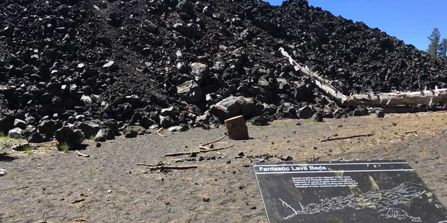
Interpretive sign of Fantastic Lava Beds
After 1.25 miles you’ll reach a signed junction label “bypass.” You’re actually on a historic trail called the Nobles Emigrant Trail which was a small section of the California Trail. Just imagine how cumbersome it must’ve been to cross this landscape in wagons in order to move your life out west. If you were to follow the bypass route, you’d find yourself on a recently acclaimed trail - the Pacific Crest Trail.
Bypass sign marks the junction below Cinder Cone
This is your last opportunity for shade, so take full advantage of this break to drink some water and refuel before the ascent.
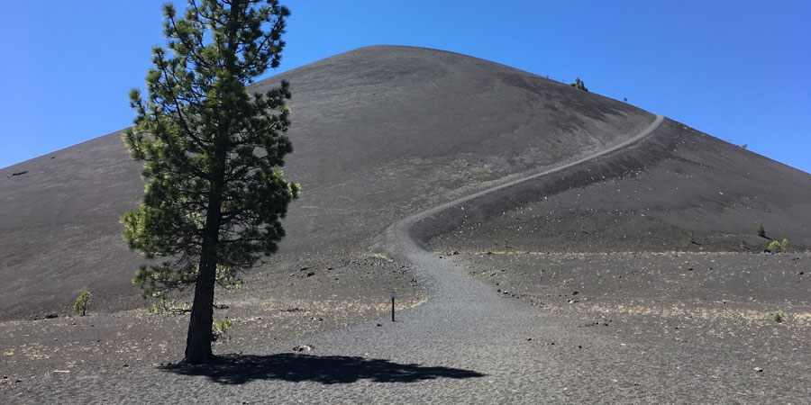
The final shade tree before climbing up the cone
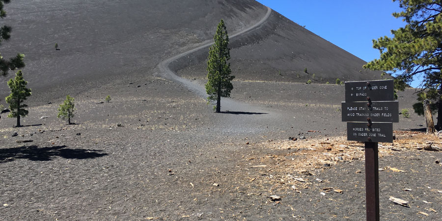
The ascent to the top of Cinder Cone is short but quite strenuous, climbing 500 feet in elevation in less than a half a mile. While the trail is nice and wide, the volcanic scree easily shifts and slides underfoot, making progress challenging. There are no notable landmarks either, so it will seem like the top is an endless distance away. Try to hold a conversational pace and you’ll make it to the top in no time.
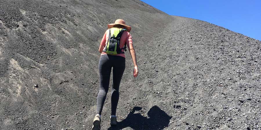
The featureless ascent
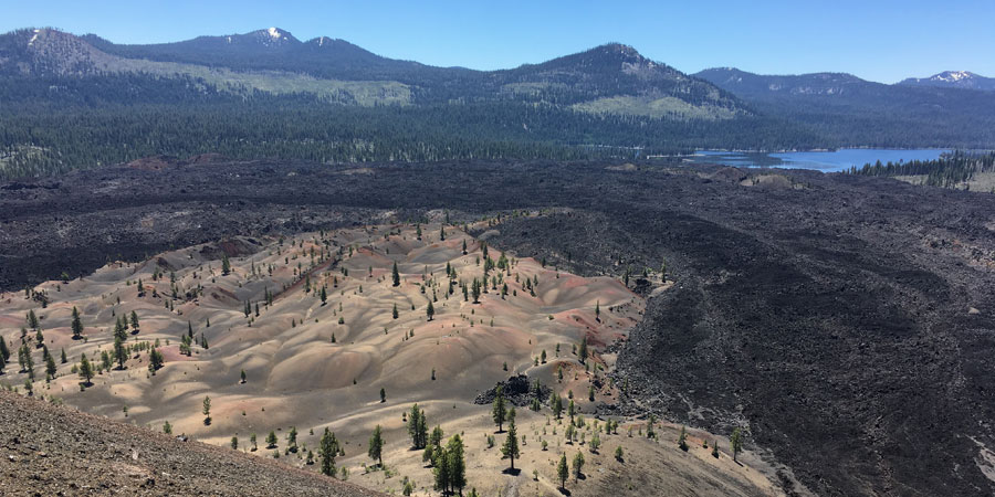
You’re instantly rewarded for the hard ascent once you top out on the rim of the cone. From here, you have spectacular views of Prospect Peak (to the northwest), Lassen Peak and the Pacific Crest Trail (to the southwest), the Painted Dunes (to the south), Fantastic Lava Beds (to the east), and Butte Lake (to the northeast).
The view from the rim of the cone
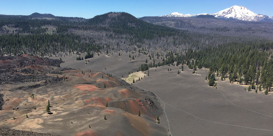
The Painted Dunes below and Lassen Peak in the distance
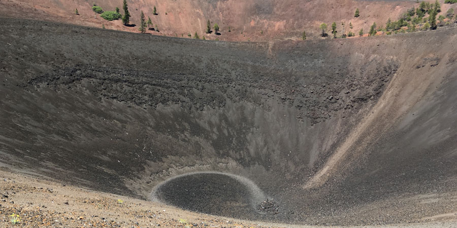
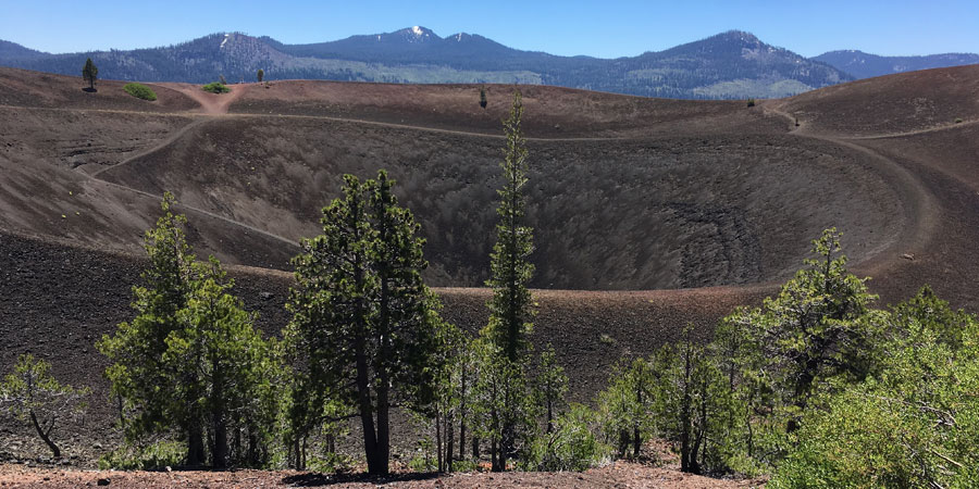
Looking into the crater
There are a plethora of trails that criss cross and circle the cone; explore them however you see fit. You can even hike down into the crater of the cinder cone, but I’ll warn you that there isn’t much to see. A descent is available on the southern edge of the cone which links back up with the bypass trail for a short lollipop route. Or, descend the way you came up.
Before you go, consider what this landscape might have looked like 400 years ago prior to the Cinder Cone eruption. Instead of Snag and Butte Lakes you’d only have the small Grassy Creek. The ponderosa forest would extend as far as the eye can see. And there would be no vibrant colors of the Painted Dunes.
Overlooking Fantastic Lava Beds
Take your time on the hike down the cone -- it’s easy to slip with the loose screen underfoot. The forest walk to the car flies by as you walk along the gradual decline. A picnic and quick dunk in Butte Lake is the perfect way to round off this adventure.