Pacific Coast Highway & Highway 101
Road Trip Guide
The Pacific Coast Highway is one of the most iconic drives in the United States. California Highway 1 (the PCH) runs 655.8 miles from its southern terminus at Dana Point, CA to its northern terminus at Leggett, CA. Some of the most breath-taking scenery is found along the way, including the oceanside mountains of Big Sur, the redwood groves of Mendocino County, and two major American metropolises.
You could easily spend months exploring just the Pacific Coast Highway, but it is just a portion of the USA’s pacific coast. Highway 101 takes an inland route through most of California, but heads out to take the PCH’s place after Leggett. 101 is a natural extension and continues on for an additional 777 stunning miles to Port Angeles, Washington. Needless to say, there is a LOT of beautiful country to explore, and that’s even before mentioning the 70 mile southern extension to San Diego.
The Pacific Coast Highway and Highway 101 Road Trip Guide highlights many of the best eateries, sights, stops, hikes, and places to stay along the entirety of the United State’s pacific coast, from San Diego to Port Angeles. The guide is broken down into five sections:
Washington
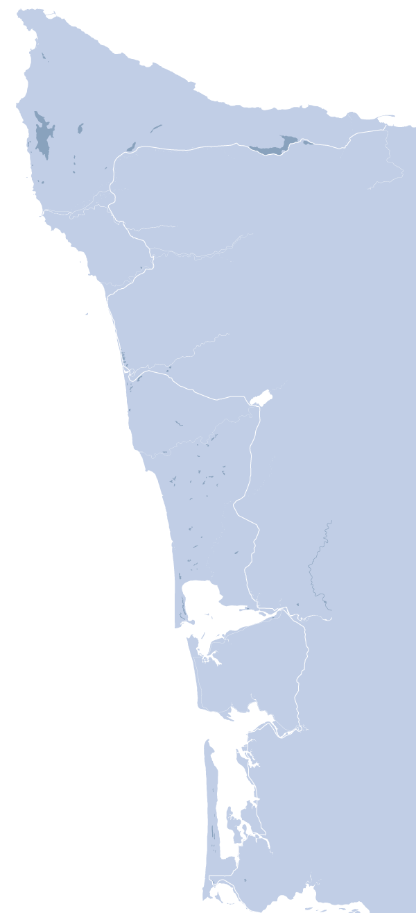
Port Angeles is situated at the northern end of Washington’s Olympic Peninsula. Highway 101 actually does a full loop around Olympic National Park, but since this is a coastal road trip guide, we are focusing on the western portion. From Port Angeles there are many opportunities to explore the national park including an alpine drive, hot springs, and rainforest hikes. You’ll go through the town of Forks, an old logging town more recently made famous by the Twilight series. The route then briefly ducks out to the coast before heading inland to cover some of the most remote regions. Two of the biggest estuaries on the USA’s pacific coast, Grays Harbor and Willapa Bay, wrap up the Washington section with unique flavors. Literally, the oysters and seafood here is AMAZING.
Click Here for Washington's Highway 101
Total driving distance = 237 miles with optional additions

Oregon
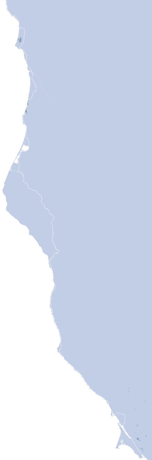
Astoria, and the massive Columbia River, mark the northern terminus of the Oregon section of Highway 101. The following 347 miles to the southern border are arguably the best of this entire guide. Most of the route is situated right next to the ocean. Oregon is a hard state to drive through, because there are cute oceanside towns even few miles that dare you not to stop. Wide sandy beaches, quirky oceanside attractions, and amazing seafood is the name of the game. Further south is the Oregon Dunes National Recreation Area, home to 500 foot tall oceanside dunes.
Click Here for Oregon's Highway 101
Total driving distance = 347 miles with optional additions
North California
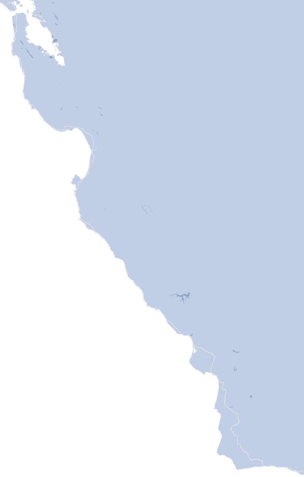
You are now in Redwood’s territory. Highway 101 heads through Crescent City before passing straight through Redwoods National Park. These huge tree keep popping up along the entirety of this section. Eureka is the last large town before the route dips inland to get around the Lost Coast. From there, you’ll jump onto the Pacific Coast Highway for the first time where it’s windy coastal roads and secluded beaches for miles. Point Reyes National Seashore provides one last stop to enjoy nature before you approach San Fransisco, crossing the Golden Gate Bridge to enter the city.
Click Here to Explore Northern California
Total driving distance = 408 miles
California's Central Coast
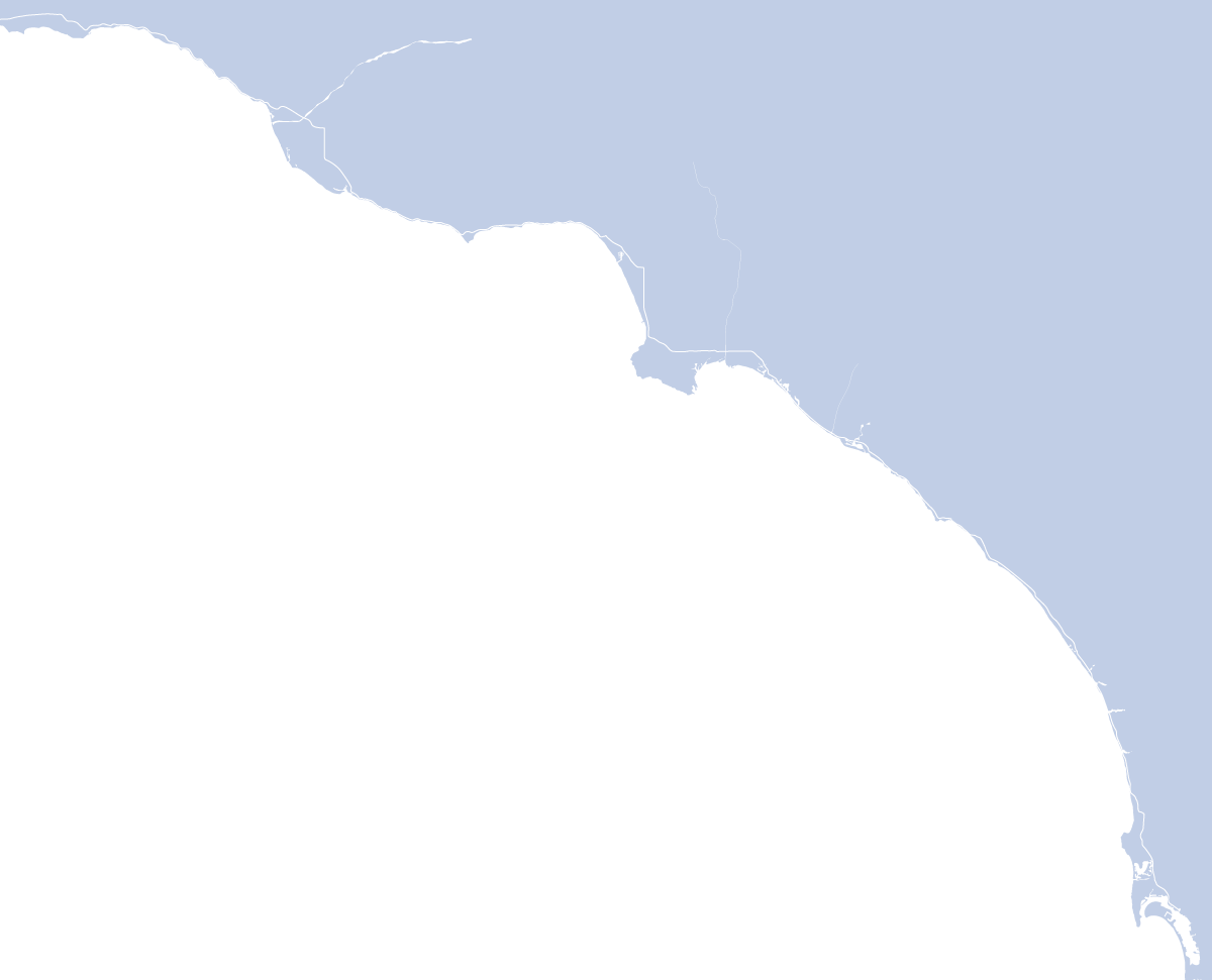
You could live in San Francisco and still miss out on the highlights, but the Pacific Coast Highway south from here includes the best of the best. You’ll follow the water south to Santa Cruz, a small city with youthful flair. Monterey is just on the other side of the bay, home to the famous aquarium and Cannery Row. Once you pass Monterey, it’s all about the Big Sur coastline. This is the most dramatic section of road as it winds above huge cliffs and thick forests. The elevation eases up and a stop at the Elephant Seal Rookery at San Simeon should not be missed. Continue on to the San Luis Obispo area for wines, seafood, and tons of natural diversity. The Pacific Coast Highway then takes a strange backroads path to the south facing the Santa Barbara coastline.
Click Here to Explore California's Central Coast
Total driving distance = 368 miles with optional additions
Southern California
Santa Barbara marks the beginning of the urban stretches of the Pacific Coast Highway. You’ll continue south on Highway 101 to Ventura before ducking off onto Highway 1 again past Malibu. Then, all of the sudden, you’re smack dab in the middle of Los Angeles. There is plenty to see and do in LA, and the PCH will guide you to some of the best spots. The Santa Monica pier and 3rd street Promenade, Venice Beach, an optional drive around the Palos Verdes Peninsula, and Long Beach are just a few of the MANY stops you could make while in LA. The Pacific Coast Highway continues for a few more miles, passing through Newport Beach, before joining up with Interstate 5 at Dana Point. While this is technically the end of the Pacific Coast Highway, I’d encourage you to drive the short addition to San Diego, which makes a much better southern terminus.
Click Here to Explore Southern California
Total driving distance = 229 miles