How long will it take to get from Point A to Point B when hiking or backpacking? You can quickly get an estimate with the aid of a topographic map, the string from your compass, the map's graphic scale, and a few basic algorithms. A good estimate of travel time allows you to better plan out your day, know when to start, and figure out when to leave so you are off the summit before storms and in camp before dark.
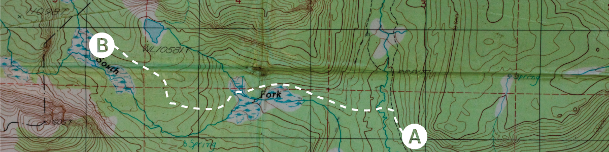
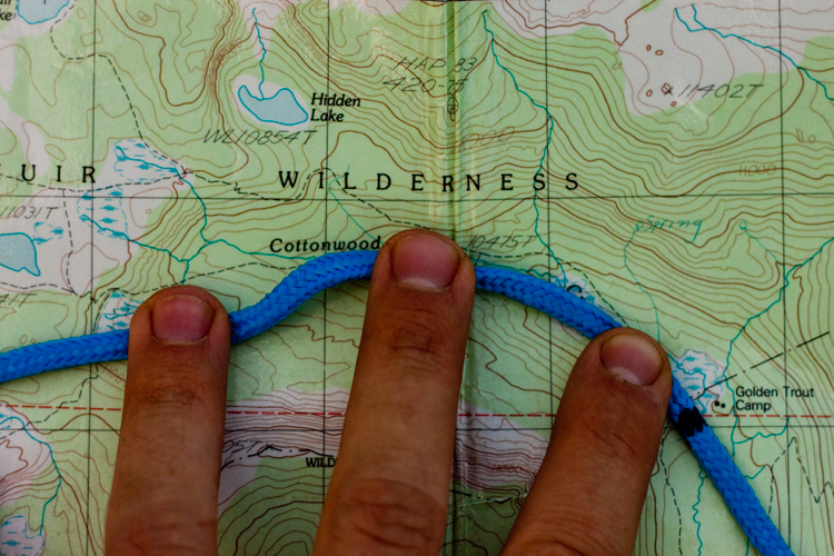
Begin by locating your starting point, ending point, and the trail(s) that will get you there. Use a string to measure the length of the route, including all of the switchbacks and curves.
HOT PRO TIP!
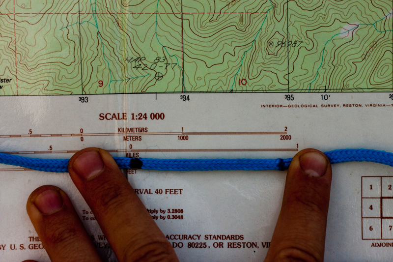
Use a black sharpie to mark one spot on your compass string. Begin at this black mark and measure out from there. This way you won't lose track as you measure.
Next, line up the string to the graphic scale. Most scales cover 2 miles, scroll your string along to calculate the total distance. Then add in another 10% to get a more conservative estimate (so 5 miles would turn into 5.5, and 10 mile would turn into 11).
You now have the total estimated mileage for the day. Take a look at your starting elevation and your ending elevation. Use index contour lines and the contour interval to help determine this accurately (read this article to learn more about contour lines).
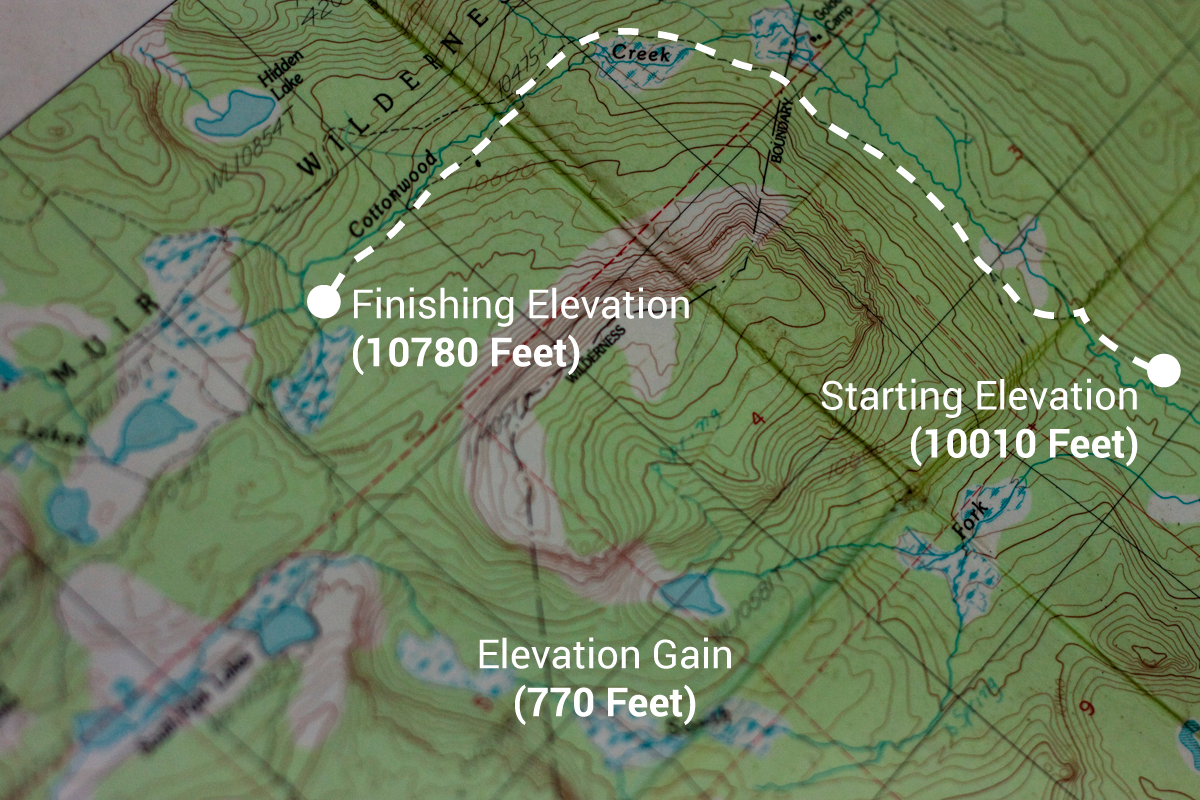
Finally, trace the path of your route and observe any elevation changes that wouldn't be accounted for in your initial estimate; for instance, areas where the trail dips and then raises significantly. Write down your total elevation gain and elevation loss next to your travel distance. Now it's time to do some calculations.
A good starting algorithm to determine your estimate travel time is...
(Distance) / (Pace Index) + (Elevation Factor) + (Rest Time)
Let's breaks that down a little further. Distance is a total of the mileage you will be traveling. Adding in a 10% fudge factor helps to maintain a conservative estimate. Pace Index (PI) is a number which refers to your specific speed (in miles per hour). A good backpacking PI to start with is 2 and for dayhikes start with 3. If you know you move faster or slower you can adjust this number accordingly. The most accurate way to get your PI numbers is to log numerous hikes (especially on flat terrain). Use our excel spreadsheet to get started. Elevator Factor helps add or remove time if your routes has big gains/losses in altitude. Adding in one hour per 1000 feet of gain is a good start. You can eliminate 30 minutes per 2000 feet of loss if it's a decent trail (not over rugged terrain). Lastly Rest Time adds in breaks. A 5 minute break every hour along with a 30 minute break every four to five hours is usually plenty of rest.
Of course, there are many other variables such as your level of physical fitness, trail conditions, load, and altitude, but this is a good place to start. As you continue to travel, keep notes on travel times. Then you can adjust your algorithm according to your personal typical pace for more accurate future estimates.
You can quickly estimate travel times using our calculator below:


